

Put your data on the map
Use the Maps app to view item locations and geometry, superimposed over basemap imagery.
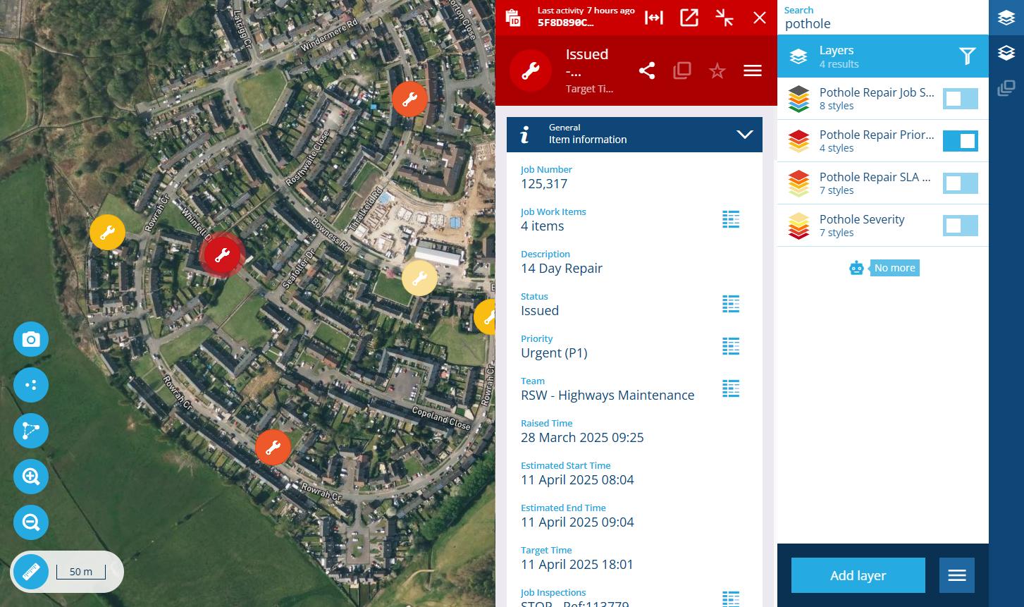
Control the data you see with layers and layer styles. The Layers panel makes it easy to turn layers and individual styles on/off as needed, enabling you to change your view and shift focus between different datasets at any time. Open items to view their details in a side panel, which can be resized and minimised to accommodate different situations and screen sizes.
Switch basemaps to change the background imagery and see your items in new contexts. Use the supplied basemaps or create your own by connecting to various online map services, e.g. Google Maps, OpenStreetMaps.
Navigate the map by mouse, keyboard or touch. Use the provided map tools to select items and accurately measure dimensions in real-time.
Access from Home
To access the Maps app, visit Alloy Home in your web browser. Select the app to launch it in the current browser tab. Alternatively, select the app's button and choose Open in new window (or use middle-click or Ctrl-click).
If you belong to multiple customer projects, use the top app bar to select the one you want to work with.
Access from other places
When you're working with a set of items in another Alloy app, it's often possible to open those items in the Maps app. Want to see all jobs in progress? All street lights maintained by a particular team? All defects reported within an operational zone in the last 12 months? No problem!
Data Explorer
To open the resulting items of a query in the Data Explorer app, select Open with in the bottom toolbar and choose Map.
Hubs
To open the set of items represented by a data point in the Hubs app, select the button beside the data point and choose Maps.
Item details
To open the contents of any canvas section that lists items related to the current item (e.g. Jobs, Reports), select the section's Open with button and choose Maps.