Add a WMS basemap
Use a standard image map service
When adding a basemap, choose Add WMS basemap to connect to a Web Map Service.
WMS is an international protocol for serving georeferenced map images over the internet. WMS typically serves one large image per request, instead of multiple smaller tiles. It can provide multiple data layers with different styles, which can be combined to produce the desired basemap imagery. Choose this if the map service's url contains wms.
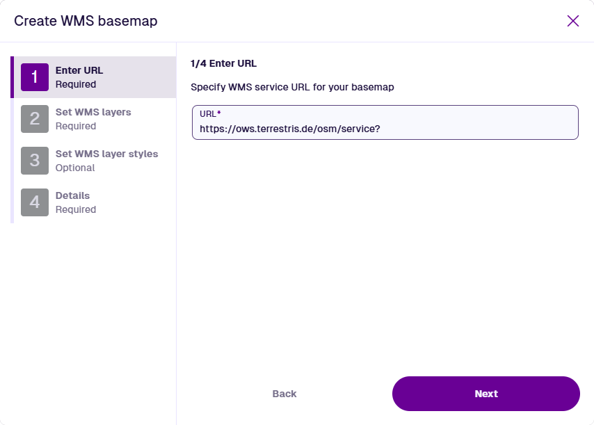
1 Enter URL
This step is required. Enter the URL of the WMS map service you want to use. A variety of URL formats are accepted, such as:
https://example.com/services/MapServer/WMS/1.0.0/WMSCapabilities.xml
https://example.com/services/MapServer/WmsServer?
Ensure the URL isn't suffixed with any parameters. If the service fails to load, try using https: instead of http: and vice versa.
Select Next to continue.
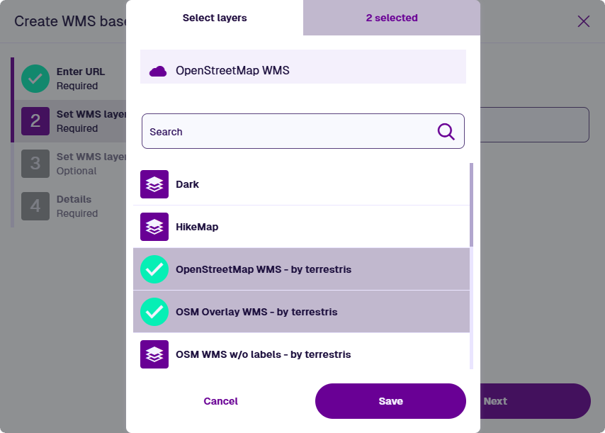
2 Set WMS layers
This step is required. Select the Select layers field to list the available data layers provided by the map service. If you select multiple layers, the map service will combine them into a single image, in the order you select them. Select one or more layers and then select Save.
Select Next to continue.
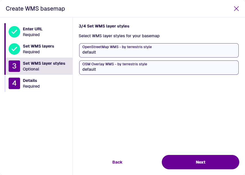
3 Set WMS layer styles
This step is required. For each previously selected layer, choose an available style provided by the map service. A layer may have multiple styles or a single default one. If no styles are available, you can leave the field blank.
Select Next to continue.
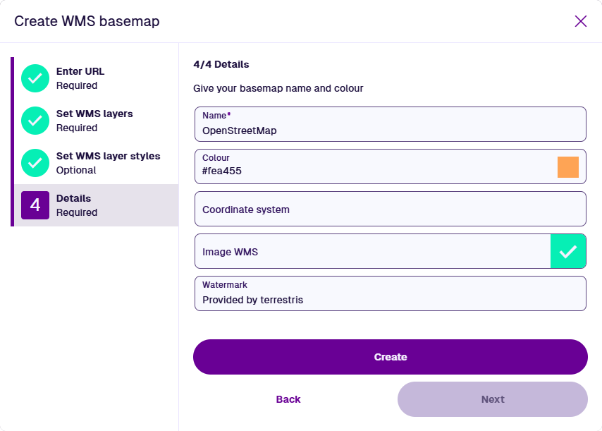
4 Details
This step is required. Fill in the following fields as needed:
-
Name * - enter a distinct name that clearly identifies the basemap.
-
Colour - use the colour picker to set the initial colour of the map area while the map is being drawn (white by default).
- Coordinate system - choose one from the list offered by the map service. If left blank, EPSG:4326 will be used. This is the WGS84 Lat/Lng system used internally throughout CausewayOne Asset Management (view on epsg.io).
- Image WMS - if enabled, the map service is requested to send the entire map as a single image.
- Watermark - enter text to be superimposed in the bottom-right corner of the basemap. To comply with the map service's licensing, it may be necessary to credit the provider here.
Select Create to finish.
Example
The WMS basemap illustrated below was created using the following URL:
https://ows.terrestris.de/osm/service?
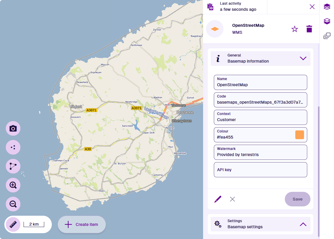
The availability of this example map service may change over time!