Edit a basemap
Change the properties of a basemap
You can edit any custom basemap added by your organisation. If the Context of a basemap is not Customer, it's a protected system basemap, though you can still edit its Name and Colour!
To edit a basemap:
-
Select Basemaps in the right toolbar and then select the basemap.
-
Select Edit in the relevant section and make your changes.
-
Select Save to finish or to cancel.
Basemap properties are organised into the following sections.
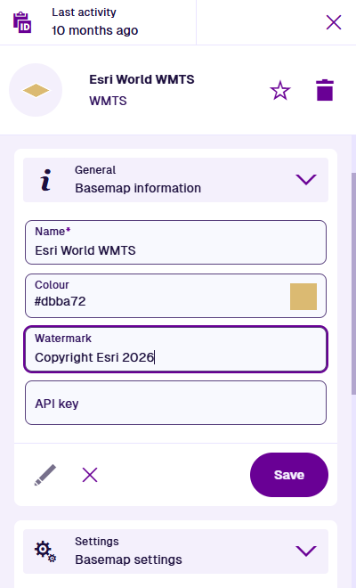
General
This section contains the basemap's main properties:
-
Name * - enter a distinct name that clearly identifies the basemap.
-
Colour - use the colour picker to set the initial colour of the map area while the map is being drawn (white by default).
- Watermark - enter text to be superimposed in the bottom-right corner of the basemap. To comply with the map service's licensing, it may be necessary to credit the provider here.
- API key - if the map service requires an API key, enter it here.
Settings
The section contains different properties depending on the basemap type.
WMS basemap
-
URL * - update the URL of the map service. This will clear all selected WMS layers.
-
WMS layers * - select one or more data layers provided by the map service. Multiple layers will be combined into a single image, in the order you select them. For each selected layer, choose a style (if any are available).
- Coordinate system - choose one from the list offered by the map service. If left blank, EPSG:4326 will be used. This is the WGS84 Lat/Lng system used internally throughout CausewayOne Asset Management (view on epsg.io).
- Image WMS - if enabled, the map service is requested to send the entire map as a single image.
WMTS basemap
-
URL * - update the URL of the map service. This will clear the selected WMTS layer.
-
WMTS layers * - choose one of the data layers provided by the map service.
-
WMTS style * - choose the style of the chosen layer.
- Coordinate system - choose one from the list offered by the map service. If left blank, EPSG:4326 will be used. This is the WGS84 Lat/Lng system used internally throughout CausewayOne Asset Management (view on epsg.io).
- High DPI tiles - if enabled, the map service is requested to send high resolution tiles (512 x 512) if available, instead of standard resolution (256 x 256).
XYZ basemap
- URL * - update the URL of the map service.
- High DPI tiles - if enabled, the map service is requested to send high resolution tiles (512 x 512) if available, instead of standard resolution (256 x 256).