Layers
Overlay data items on the map
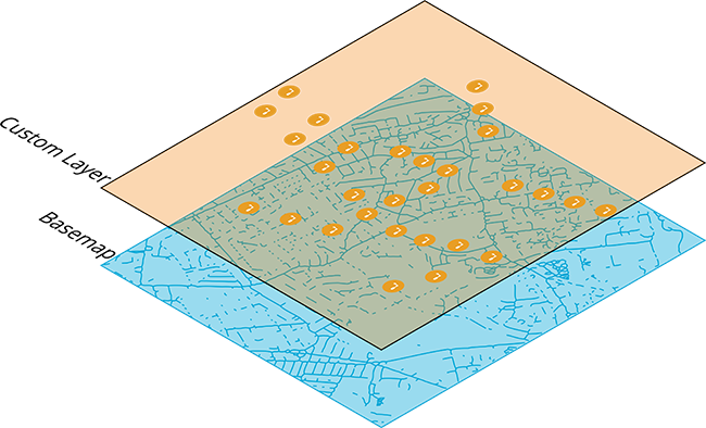
A layer represents a defined set of items that can be displayed on the map. You can create any number of layers and easily turn them on or off as needed, giving you a clear picture of the assets and activities you're interested in at any given time.
When you turn on a layer, its items appear as a map overlay, providing a visualisation of their locations and proximity to each other. You can open items to view their details and select multiple items for processing in the Data Explorer app.
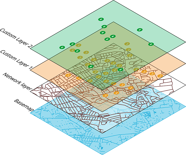
There are three types of layers:
-
System - layers included with CausewayOne Asset Management (e.g. Defect Status) or in optional modules (e.g. Street Lighting).
-
Custom - layers created by you or other users in your organisation
-
Network - special layers that display network items beneath other active layers. To learn more, see Network in Asset Classic.
The layer structure of your company project can be as simple or complex as you want it to be. With large data sets, it can be challenging to keep track of all items, especially if small ones get hidden under large ones.
Fortunately, the Layers panel makes it easy to show, hide and change the appearance of items on the map.
Developers can use the Alloy API to extract layer data for external use! See the Developer Docs.
Layer styles
Each layer has one or more layer styles, which collectively determine the data displayed by the layer. Each style acts as a separate database query, fetching items that meet its defined criteria.
You can turn styles on/off individually or all at once by turning the layer on/off. This makes it easy to compare different sets of data visually, giving you more contexts for making decisions.
To learn more, see Layer styles.