Layer styles
Define the data items shown by a layer
A layer needs one or more layer styles to display data on the map.
Each layer style performs its own query, fetching items of a design/interface that meet specific criteria. When a layer is turned on, each layer style can then be turned on or off individually, enabling you to visualise different subsets of the data represented by that layer.
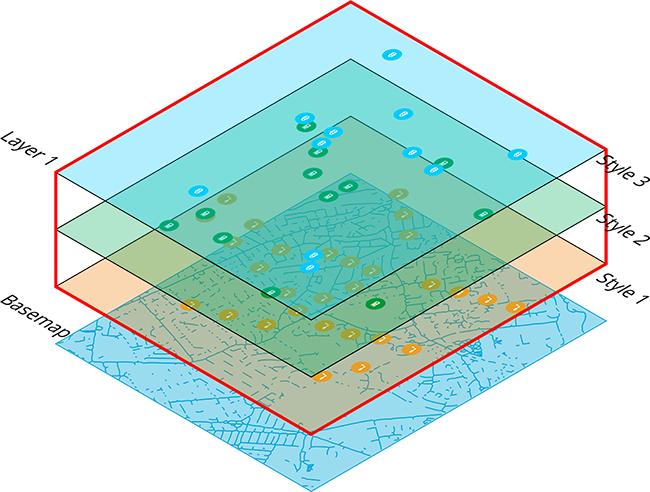
When viewing a layer's details, you can manage its styles in the Layer styles section. Use the switches to turn specific styles on or off as needed, so that their corresponding items appear on the map. You can edit existing styles to change their appearance and behaviour. For custom layers, you can add styles to display the data that's important to your organisation.
For example, the layer shown below contains five layer styles. Each style displays items of the Carriageway Inspections design with a specific value for their Status attribute.
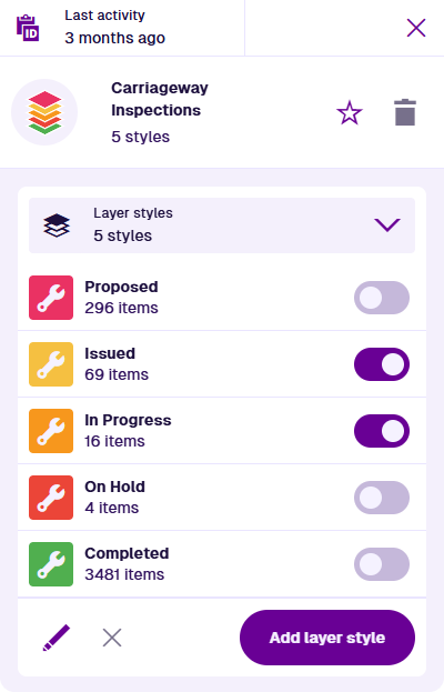
When you turn a layer on/off, all of its styles are also turned on/off.
Visualisations
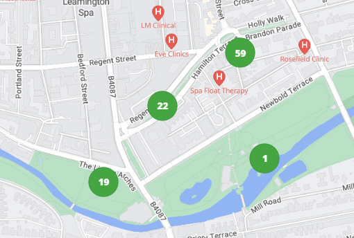
By default, if a layer style displays multiple items close together, they gradually merge into numbered clusters as the map zooms out. This reduces clutter on the map, while still indicating the number of items in the vicinity. As you zoom in, the clusters gradually separate into individual items. This can be disabled as needed.
To learn more, see the General section in Edit a layer style.