Navigation
Find your way around the map
The map gives you a spatial view of your assets and their data, placing everything in its geographic location.
Jump straight to an address or set of coordinates. Or pan, zoom and rotate to focus on what matters. You can select items individually or in groups, measure dimensions and save screenshots of any view.
Location search
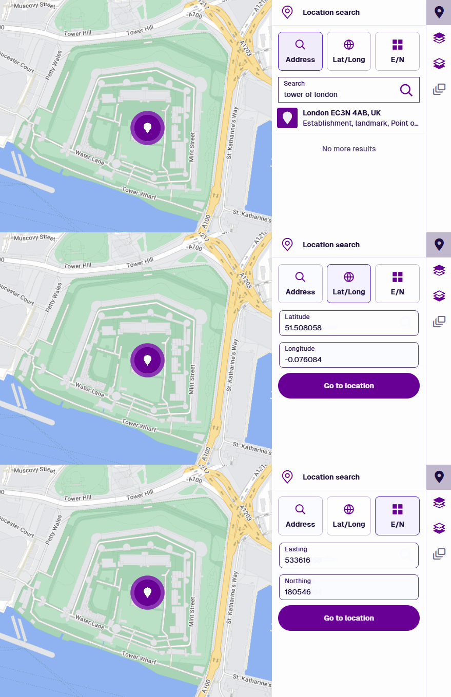
To zoom to a specific location on the map, select Location search in the right toolbar, then choose a method:
-
Address - enter any part of an address, business name or landmark. Press Enter to see the results, ranked by proximity to your current position.
-
Lat/Long - enter latitude and longitude coordinates in decimal degree format (WGS84).
-
E/N (UK only) - enter easting and northing coordinates (OSGB36 / British National Grid).
Select an address result to zoom to its location, or select Go to location after entering coordinates.
Map controls
The map supports mouse, keyboard and touch controls for navigation.
| Action | Mouse | Keyboard | Touch |
|---|---|---|---|
| Pan | Drag in any direction | Up Down Left Right | Single-finger drag |
| Zoom in | Scroll up or double-click | Plus | Pinch open |
| Zoom out | Scroll down or hold Shift and double-click | Minus | Pinch close |
| Zoom to area | Hold Shift and drag diagonally to draw a box | — | — |
| Rotate | Hold Shift + Alt and drag sideways | — | — |
Map tools
Use the tools in the bottom-left corner to interact with the map and any items on it.
| Tool | Name | Description |
|---|---|---|
| Save map image | Download a JPG screenshot of the current map area, including all visible layers and networks. If the screenshot is blank, the map service of the active basemap may forbid image exports (due to its cross-origin configuration). Contact the map service provider for assistance or change the basemap. | |
| Toggle selection | Select multiple items on the map. Select the tool, then select each item in succession. | |
| Draw selection area | Select multiple items on the map. Select the tool, then select multiple points around the items to draw your selection. Select the last point twice to finish.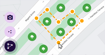 | |
| Pan controls | Select the tool to reveal four direction buttons. Use them to move the map up, down, left and right. | |
| Zoom in | Zoom into the centre to see more detail. | |
| Zoom out | Zoom out from the centre to show a wider area. | |
| Measure | Draw lines or polygons on the map to measure length and area. |