Layers
What is a layer?
Items can have geometry that describes their location and shape. This can be projected onto a basemap of your choice, enabling you to visualise physical assets, activities, service areas and more, within a geographical context.
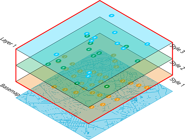
Each set of item geometries is known as a layer. You can create any number of layers and easily turn them on or off as needed, making it possible to view multiple datasets alongside each other on the map.
Layer styles
Each layer consists of one or more layer styles. Each style uses an AQS query to fetch a set of qualifying items and display them on the map (e.g. all residential Waste Containers with unresolved defects).
You can define the colour, icon and query of each layer style. To determine how items are arranged and presented on the map, you can also configure the layer style's visualisation type.
You can enabled layer styles on an individual basis. Turning the layer on or off will show/hide its enabled layer styles accordingly.
Learn more
To learn more about viewing and managing layers, see Layers in the Maps app.