Geometry attribute
Store location and geometry coordinates
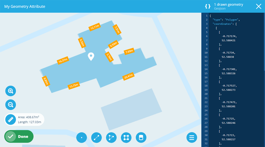
A Geometry attribute can store geometry coordinates in GeoJSON format.
While all designs/interfaces inherit a standard Geometry attribute via the Items interface, you can add additional Geometry attributes to hold other location information.
To configure the standard Geometry attribute, see Editing design general details.
Configuration
When adding or editing a Geometry attribute on a design/interface, you can configure the following properties:
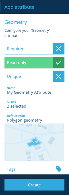
- Name * - enter a distinct name that clearly identifies the attribute.
-
Required - if enabled, the attribute will need to be populated with a value before the item can be saved. It can't be left blank!
-
Read-only - if enabled, the attribute can only be populated when creating items. It can't be edited later!
-
Unique - if enabled, the attribute won't accept a value that's already stored in the same attribute on another item of this design/interface.
-
Allows - the attribute will only accept the selected geometry types.
-
Default value - use the Geometry Editor to draw some geometry. The attribute will automatically be populated with these coordinates, unless another value is entered.
-
Tags - use the Tag Manager to select a custom tag or relevant system tag.
The Code field is read-only. It displays the attribute's Global Unique Code (Guc).
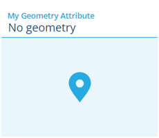
Populate the attribute on items
When creating or editing an item, select the attribute to draw the desired geometry with the Geometry Editor (or paste in existing GeoJSON coordinates).
To populate the standard Geometry attribute, see Editing item geometry.