Adding basemaps
Use any map service as a basemap
CausewayOne Asset Management supports most types of online map service. By adding a basemap, you can connect to one of these map services and display its imagery.
You can add any number of basemaps to your company project. If necessary, admins can use permissions to restrict access to individual basemaps for different groups of users.
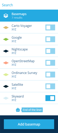
To begin, select Basemaps in the right panel menu and then select Add a basemap.
In CausewayOne Asset Management, all geometry is saved using the WGS84 Lat/Lng (EPSG:4326) coordinate system.
While you can add basemaps with different coordinate systems, note that item geometry will be automatically transformed (by us or the map service) while being displayed. As a result, item geometry may appear slightly misaligned with the basemap.
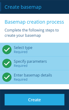
The basemap creation process
The key steps of this process will appear in the dashboard panel:
-
1 Select type - required
-
2 Specify parameters - required
-
3 Enter basemap details - required
Fields marked with an asterisk * require a value to continue.
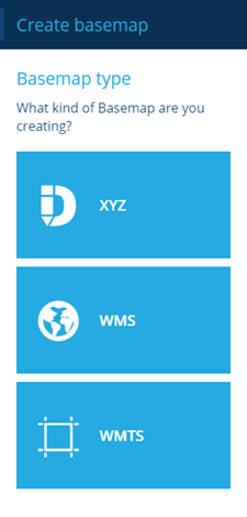
1 Select type
This is a required step. Select the type of map service you want to use:
-
XYZ - a tiled map service (or slippy map in OpenStreetMap terminology). The map is displayed by requesting many smaller images (or vector data files) from the service and seamlessly joining them together. Select this if the map service's URL contains
{x},{y}and{z}. -
WMS - Web Map Service is a standard protocol developed by the Open Geospatial Consortium for serving georeferenced map images over the internet. These images are typically produced by a map server from data provided by a GIS database. WMS serves one image per request. Select this if the map service's URL ends in
mapserv? -
WMTS - Web Map Tile Service is a standard protocol for serving pre-rendered or run-time computed georeferenced map tiles over the internet. WMTS serves multiple tile images per request. Select this if the map service's URL ends in
WMTSCapabilities.xml.
2 Specify parameters
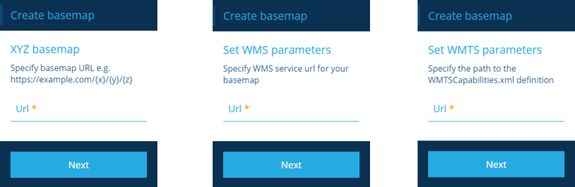
This step is required. Enter the URL of the map service. The format differs depending on the type chosen previously.
XYZ basemap
A variety of XYZ URLs can be accepted, such as:
-
http://domain.com/service/{z}/{x}/{y} -
http://domain.com/service?z={z}&x={x}&y={y} -
http://domain.com/service/{x}/{y}/{z}.png
Select Next to choose the next step.
Set WMS parameters
A WMS URL typically looks like this: https://domain.com/service/mapserv?
Select Next to move to the next page.
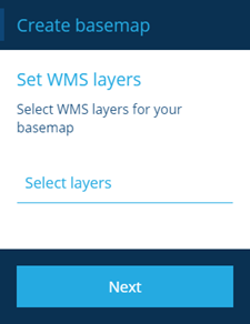
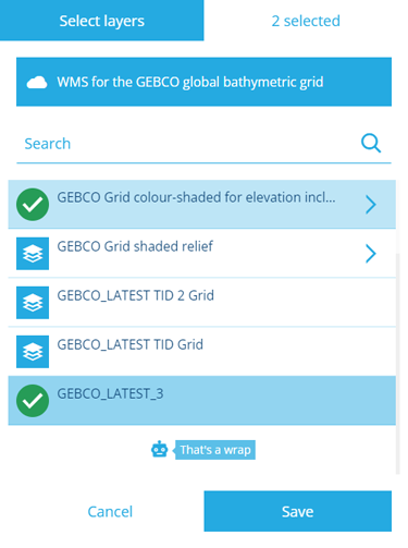
The Select layers field will list the available data layers provided by the map service. Select the ones you want and then select Save.
Select Next to move to the next page.
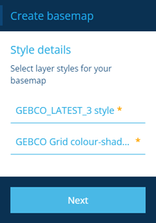
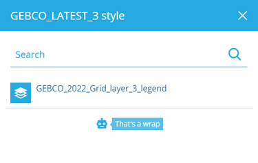
There will be a field for each layer you selected. Select each field to choose an available style for that layer.
Select Next to choose the next step.
Set WMTS parameters
A WMTS URL typically looks like this: https://domain.com/service/wmts/1.0.0/WMTSCapabilities.xml
Ensure the URL begins with https (not http) and doesn't include any layer parameters at the end.
Select Next to move to the next page.
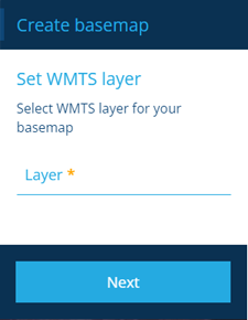
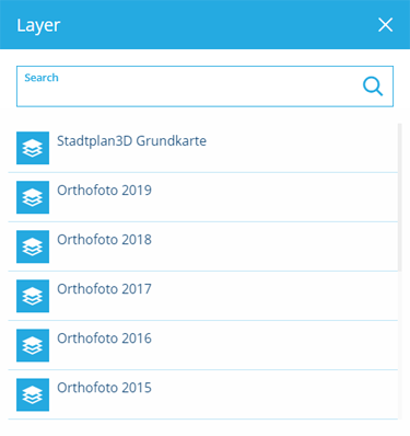
The Layers field will list the available data layers provided by the map service. Select one and then select Save.
Select Next to move to the next page.
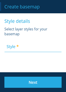
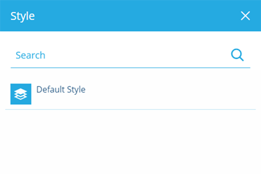
The Style field will list the available layer styles provided by the map service. Select one and then select Save.
Select Next to choose the next step.
Select Next to continue.
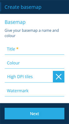
3 Enter basemap details
This step is required. Fill in the following fields according to the map server type and your preference.
| Field | Description | XYZ | WMS | WMTS |
|---|---|---|---|---|
| Title * | Enter a distinct name that clearly identifies the basemap | ✔ | ✔ | ✔ |
| Colour | Use the colour picker to set the initial colour of the map area while the map is being drawn (white by default) | ✔ | ✔ | ✔ |
| Coordinate System | Choose one from the list offered by the map server (otherwise EPSG:4326 will be used) | ✔ | ✔ | |
| High DPI tiles | If enabled, the map server is requested to send high resolution tiles (512 x 512) if available, instead of standard resolution (256 x 256) | ✔ | ✔ | |
| Image WMS | If enabled, the map server is requested to send the map as a single image, instead of a tile set | ✔ | ||
| Watermark | Enter text to be superimposed in the bottom-right corner of the map area (required by some map servers) | ✔ | ✔ | ✔ |
Select Next to choose the next step.
Finish the process
After completing all the steps, select Create to finish.
A notification indicates whether the basemap was created successfully or an error occurred.