In CausewayOne Asset Management, the map is always at the centre of your workspace, and is designed to be as intuitive as possible to control and use.
Navigation controls
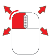
You can use a mixture of keyboard, mouse and touch controls to navigate around the map.
Pan the map
| Action | Description |
|---|
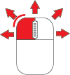 | Drag the map in any direction to pan around it. |
 | Select anywhere on the map and then use the arrow keys to pan around it. |
Zoom in
| Action | Description |
|---|
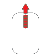 | Roll the mouse wheel forward to zoom into the map at the current mouse pointer position. |
 | Double-click a point on the map to zoom into it. |
 + +
 | While holding the Shift key, click and drag a box over an area, and then release to zoom into that area. |
 | Select anywhere on the map and then use the Plus key to zoom into the centre. |
Zoom out
| Action | Description |
|---|
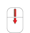 | Roll the mouse wheel back to zoom out of the map from the current pointer position. |
+
| While holding the Shift key, double-click a point on the map to zoom out from it. |
 | Select anywhere on the map and then use the Minus key to zoom out of the centre. |
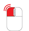
Rotate the map
| Action | Description |
|---|
 + +
| While holding the Shift and Alt keys, click and drag the map to rotate it in any direction. |
| Tool | Description |
|---|
| The Save Map Image tool lets you capture a screenshot of the current map area and download it as JPG. It will include items from all layers and networks that are visible at the time.
Note: if the saved screenshot is blank, it means the current basemap uses a map service whose cross-origin configuration forbids this. Contact the map service provider for assistance. For now, try switching basemaps. |
| The Toggle selection tool lets you select multiple items on the map. After enabling the tool, you can then select each item in succession. |
| The Draw selection area tool lets you select multiple items on the map. After enabling the tool, select points around the items to draw a polygon around them. Select the last point twice to select the items inside. |
| Zoom into the centre of the map. |
| Zoom out from the centre of the map. |
| The Measure tool lets you draw lines and polygons on the map and displays their measurements in real-time. |