Measuring length and area
Draw lines and polygons on the map
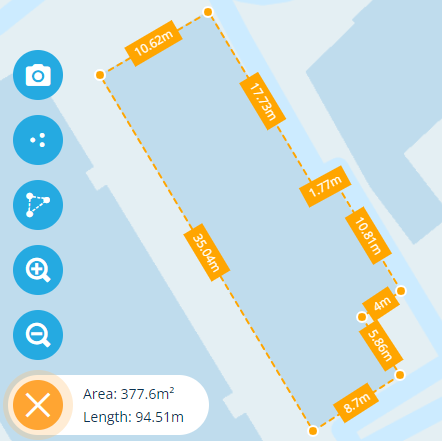
You can accurately measure the length between two points on the map, the total length between multiple points, and the area of a polygon (closed shape).
This reduces the need to visit sites, thereby saving considerable time, costs and emissions.
Using the Measure tool
To draw measurement lines on the map:
-
Select the Measure tool (bottom-left).
-
Select two points on the map to draw a line between them.
-
Continue selecting points to draw more lines.
-
Double-select the last point to finish your initial drawing. If you're drawing a polygon, do this over the first point to close the shape.
-
If necessary, you can then adjust your drawing by dragging any of its points, or adding new points along any of its lines.
The length of each line is calculated and displayed in real-time, as is the total Length and Area (if applicable) displayed in the bottom-left corner. To clear what you've drawn, select .